

Athens | Rome | Tokyo
MED_CITY
Zagreb
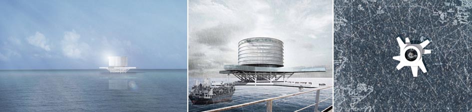
For centuries the Mediterranean Sea has been characterized by the mobility of people and goods, and sharing knowledge. The Portolano Maps, the common guides for sailors, were the instrument for sailing orientation; they pointed the right direction to safe and acquainted places along the coastline. Today we need to re-think this map on account of new travelers. The itinerary of illegal immigration shows a double layered map: the routes of illegal, unsafe, dangerous and military controlled sea travels towards close and easy reachable arrivals; and the main routes that connect ports and the main cities. Most of the time migrants are trapped in these routes, pending their admission or deportation. Today the Mediterranean Sea has become a place of confinement. A modern Portolano map is necessary because of the new “sailors”. New reference points are needed. The proposed map counts three new ports, located in international waters at the cross